India Nightlight Analysis.
Pincode-level economic activity extracted from NASA VIIRS night-lights
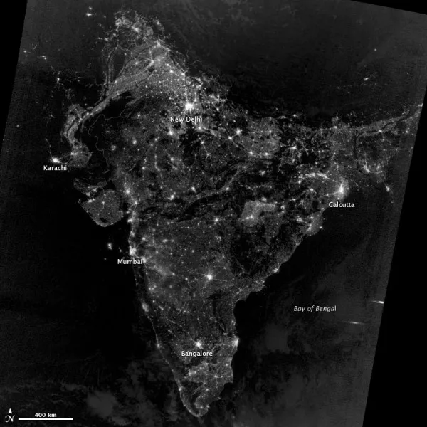
NASA VIIRS DNB clipped to every Indian pincode boundary
Per-PIN time-series of mean nighttime radiance
Cloud masking + stray-light correction built in
Hyperlocal proxy for electrification & urbanisation
A geospatial pipeline that ingests NASA's VIIRS DNB nighttime-light imagery through Google Earth Engine, clips it against India's pincode boundary shapefiles, and emits a per-PIN time-series of mean radiance. The output is a hyperlocal proxy for electrification, urbanisation and economic activity that complements (and often beats) census data for off-cycle years. Pipeline handles cloud masking, stray-light correction and pincode boundary edge cases, and exports clean GeoJSON / CSV for downstream economic modelling.